Using Maps to Structure Geographic Information
Geography is fundamentally concerned with the ways in which physical and human processes and activities order the Earth's surface into mappable patterns.
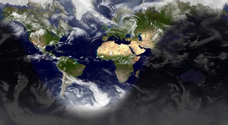
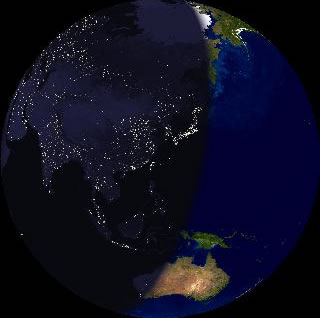 Satellite images of earth, combined to illustrate simultaneous night time all over, shows populated areas using electricity at night. Areas that are relatively dark may also be populated but use little or no electricity. View of the earth from 147,927,537 km above 26°30'N 124°17'E [Earth and Moon Viewer]
Maps and aerial views are critical tools in helping us visualize the Earth's spatial patterns and associations that we observe in natural (PHYSICAL) as well as cultural (HUMAN) geographic landscapes.
Our goal is to understand the physical and cultural complexity and diversity of East Asia — China, Japan, Korea, and Vietnam.
Maps can show us:
Political Boundaries
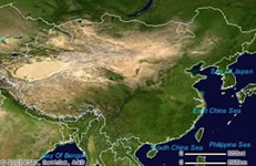
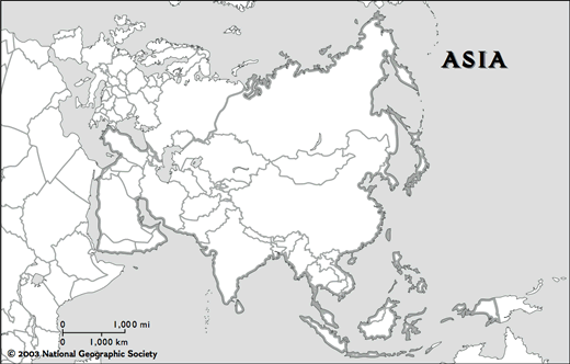
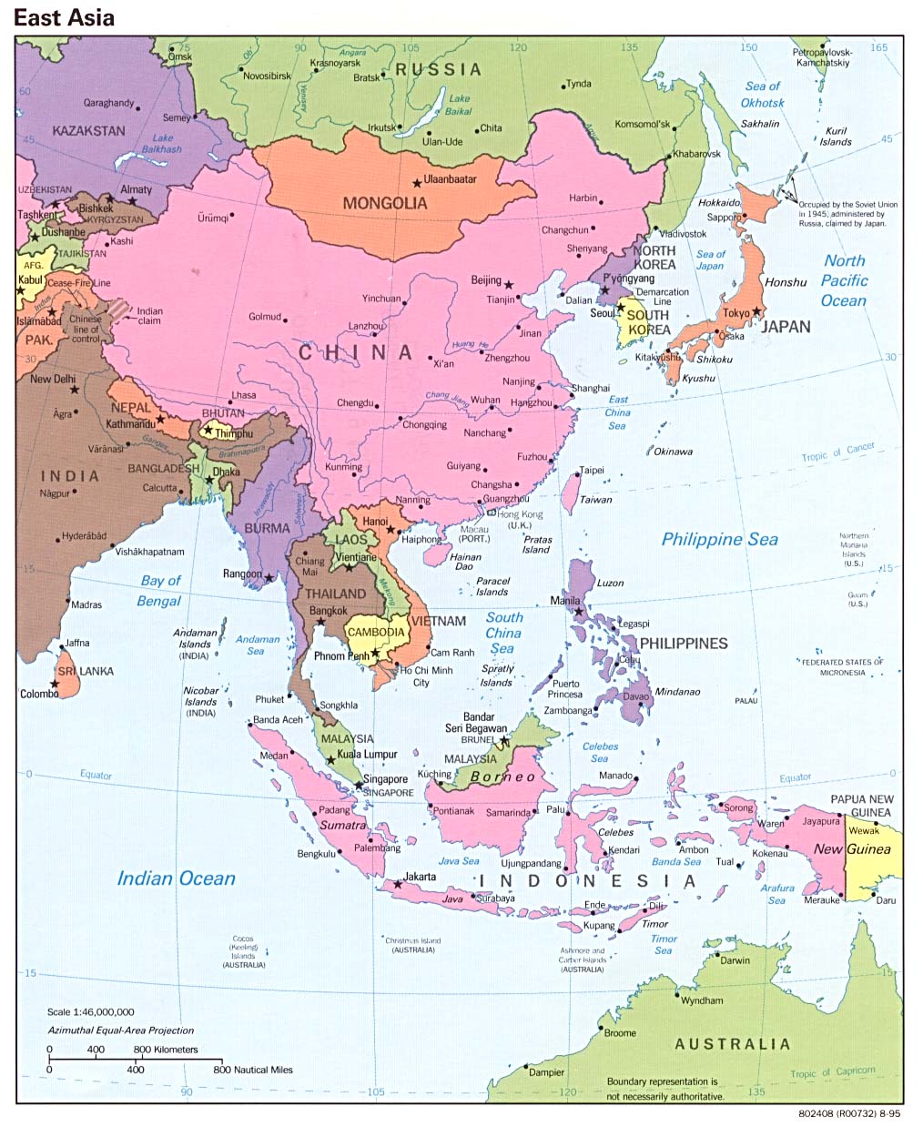
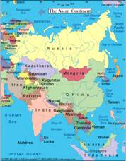 Asia at large
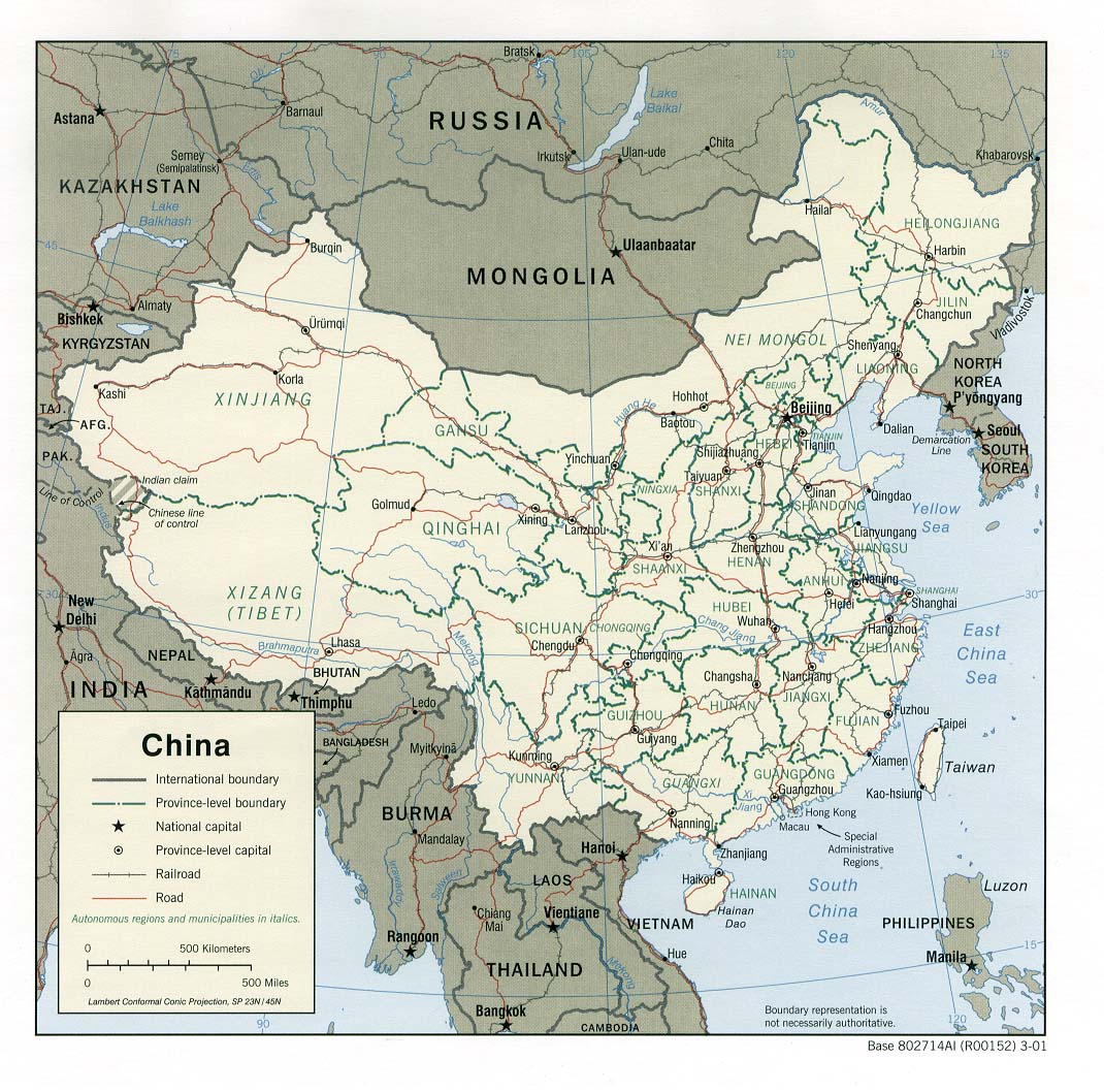
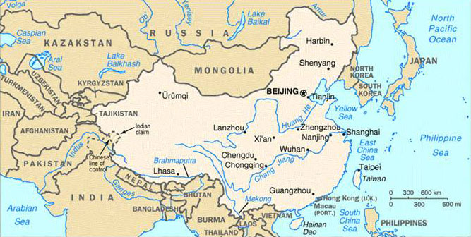 China and bordering countries
Population Density
 Satellite images of earth, combined to illustrate simultaneous night time all over, shows populated areas using electricity at night. Areas that are relatively dark may also be populated but use little or no electricity
 Comparing the United States and China
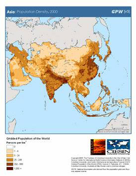
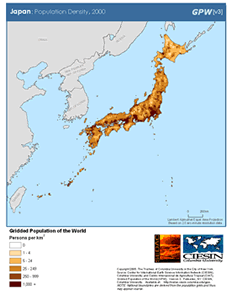 Population density of Japan
Topography
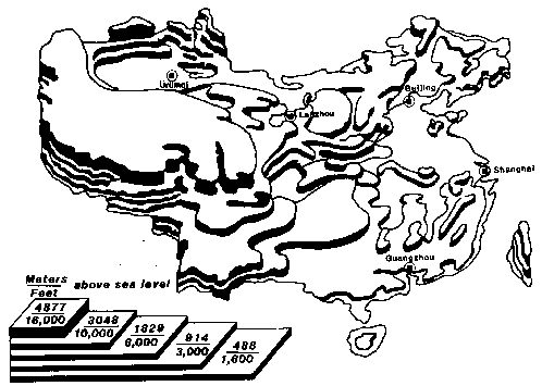
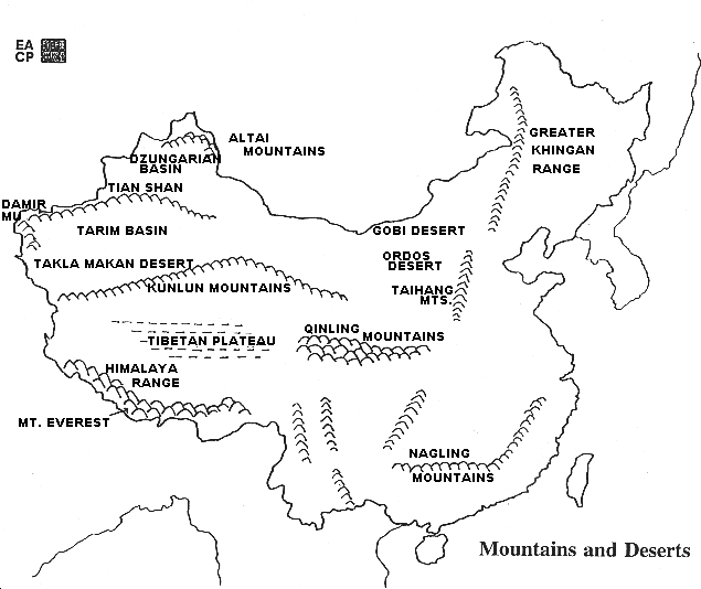 Outline map of China's mountains and deserts
 National Geographic MapMachine:
 Topographic map of China and Korea
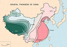 USGS contour maps of China's
 crustal structure
2. Is it easy to travel across China's borders in terms of the terrain?
3. In which continent is China?
- Asia Maps at WorldAtlas com
- Gridded Population of the World and Global Rural-Urban Mapping Project: Asia [SEDAC: Socioeconomic Data and Applications Center]
Featuring a downloadable PDF map showing population density in Asia for the year 2000.
-
Google Maps
Explore Asia through scrolling and the lower right contros to find the "Layers" function. Both the "Satellite" map type and the "Terrain" detail will show the topographical map overlaid with political boundaries.
- An Introduction to the Geography of China [Asian Art Museum of San Francisco]
Much of China, a country slightly larger than the continental United States, is hilly or mountainous. To its east lies the Pacific Ocean; to its south thick jungles.
-
China’s Geography [Asia for Educators]
This easy-to-navigate website features downloadable maps of varying scale and levels of detail.
Map-Making Problems
One of the problems map-makers encounter is that the globe is a sphere and maps are two-dimensional. There are a variety of "projections" used to represent the globe in two dimensions.
Mercator Projection
In a Mercator Projection Map the latitude and longitude lines are kept at right angles with the result that land masses are distorted increasingly towards the North and the South Poles, so that Greenland looks larger than South America, even though it is only 1/8 the area. This projection is useful for navigation as the cardinal directions are always straight, whether East to West or North to South.
Peters and Hobo/Dyer Projections
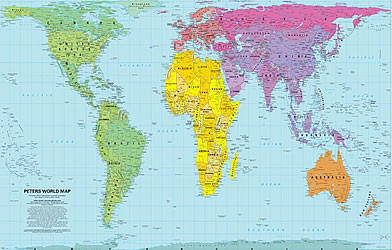 Peters Projection Map
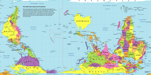
Compare the Mercator, Mollweide, and equirectangular projection maps
Use the World Sunlight Map website featuring a real-time, computer-generated illustration of the earth's patterns of sunlight, darkness, and cloud cover based on current weather satellite data — to compare:
- the Mercator,
- Mollweide,
- and equirectangular projection maps
Using Mental Maps
We all carry in our heads "mental maps" of the world we encounter. Mental maps include objective, actual information, as well as more subjective, often imprecise perceptions we have.
Eurasia and Asia
- Where is "Asia"? And what constitutes "Asia"?
- Does Europe actually exist as a separate continent? Is there a "myth of continents"?
- What does "East" Asia signify?
-
What is Asia? [Asian Art Museum, San Francisco]
“Asia” is a term invented by the Greeks and Romans, and developed by Western geographers to indicate the land mass east of the Ural Mountains and Ural River, together with offshore islands such as Japan and Java. -
Eurasia Outline Map A small scale outline map with country boundaries.
-
Outline Maps of Asia [Houghton Mifflin Education Place]
Printable outline maps, blank and labeled. All are PDF files. -
Perry-Castañeda Library Map Collection [The University of Texas at Austin]
An excellent resource for maps of Asia: NOTE DATES - East Asia
- China
- Japan
- Korean Peninsula
- Vietnam
Analyzing Spatial Organization of People and Places
China
China's Boundaries
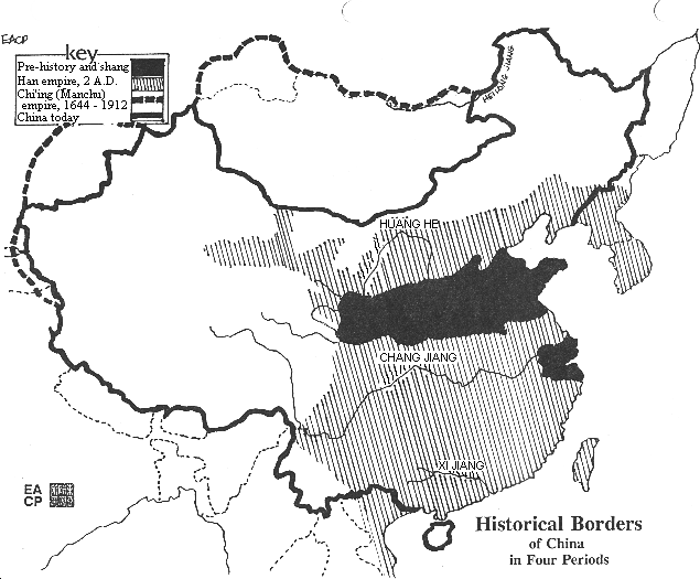
China's boundaries, both political and coastal, have changed many times over 4000 years.
China's Historical Borders
Like many other countries, the historical borders of China have varied over time. Under the Han dynasty (202 BCE-202 CE)—China's great historical empire—these early boundaries were significantly expanded. The extent of China's territory was greatest under the last dynasty, called the Qing (Ch'ing) or Manchu dynasty (1644-1912).
- China Dynasty Maps [Minneapolis Institute of Art]
Visual application showing the changes in China's boundaries, dynasty by dynasty
QUESTIONS FOR DISCUSSION: Historical Borders
- Have China's historical borders changed over time?
- Can you draw conclusions about the political power(s) of each dynasty by comparing the maps of China in succeeding dynasties?
-
A Visual Sourcebook of Chinese Civilization [University of Washington]
—Geography:
"Chinese civilization arose in a particular geographical context." A brief introduction.
Questions to consider while reading:- How did geographical location affect Chinese contacts with other early civilizations?
- Through what kinds of different terrain did Chinese civilization spread?
- Why are minorities more common today in some areas than others?
- Historical Borders of China in Four Periods [Asia for Educators]
- What's in a Map? [Field Museum, Cyrus Tang Hall of China]
Students will analyze the many different maps in the Cyrus Tng Hall of China and draw conclusions about the purpose, audience, and potential bias in maps in general.
- There is no one China (interactive map of regions)
- China Through Time: Changing Borders (video)
- There is no one China (interactive map of regions)
-
China Through Mapping [Annenberg Learner]
Mimi Norton teaches second grade at Solano Elementary School in Phoenix, Arizona. In this lesson, students learn about China's position on the globe and the location of important landmarks within the country. As a class, students create a giant map of China on the floor. Working in teams, students complete mapping tasks at classroom stations, focusing on the five themes of geography. As a culminating activity, students solve an interactive detective mystery created by Ms. Norton and work in small groups to solve problems based on their mastery of the map of China.
China's Bordering Nations
China is at the core of a cultural sphere or region known as East Asia. Looking at a map of China's bordering nations, it is possible to identify China's neighbors, some of which received substantial cultural influence from China. China, Korea, Japan, and Vietnam historically form the East Asian or Sinic cultural sphere. The large number of countries with which China shares borders makes Chinese foreign policy especially complex (unlike the U.S., for example, which shares borders only with Canada and Mexico).
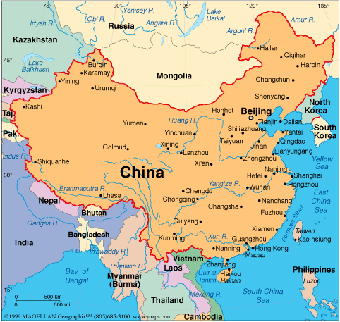
Using a map of China and the neighboring countries that surround it:
- Divide the class into groups to estimate what types of political relations China might have with the country the group has chosen, based on the geographic features and data:
- Do the countries share a body of water?
- Are there land barriers, such as deserts or mountains, separating the two countries? What type of political relations might they expect if it is hard to cross from one country to another? If it is easy?
- With how many countries does China have a common border?
- What countries in East Asia were particularly influenced by China
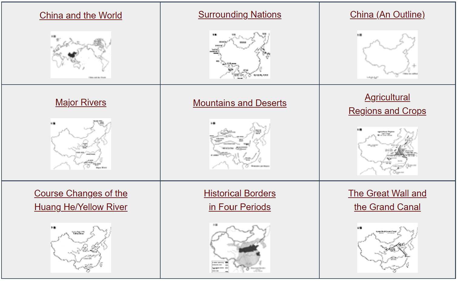
- Outline Maps of China [Asia for Educators]
Outline maps designed to be used as transparencies that can be overlaid on an overhead projector to demonstrate the diversity of China's physical and cultural geography. Copies can be printed out and reproduced also for student use. Includes outline maps of China and the World, and China and Surrounding Nations.
Schematic Physical Maps of China (B/W) [Florida Geographic Alliance]
- China: Geography and Security Goals [Asia for Educators]
This unit explores how history and geography set the agenda for Chinese foreign policy. China's internal geography, regional geography, and the broader global context are discussed. Discussion questions included.
China's International Relations [Asia for Educators]
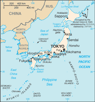
Japan
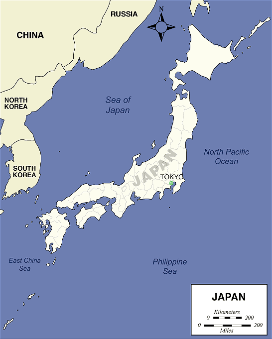
Japan's Boundaries
Japan's present-day boundaries are all coastlines:
- The Arts of Asia: History & Maps [Minneapolis Institute of Arts]
Provides maps of Japan's historical periods, as well as
- the historical periods of Korea
- the Mongol Empire
- the Silk Road
- present-day maps of China, Japan, Korea, India, Southeast Asia, Nepal, and Tibet
- Japan's Geography [Asia for Educators]
Introduction with maps
- An Introduction to the Geography of Japan [Asian Art Museum of San Francisco]
Part of a long archipelago off the eastern rim of the Asian continent, the island country of Japan has four main islands: Hokkaido, Honshu, Shikoku and Kyushu. Learn more.
- Exploring Japan's Geography through Visual Analysis [Asian Art Museum of San Francisco]
Students will: Build geographical awareness by identifying geographical features and resources that are specific to Japan; analyze now these features affected Japanese culture and economic life, and develop argumentative responses utilizing their conclusions.
- Geography of Japan [Japan Digest / SPICE]
A succinct overview of Japan's geography, covering the following topics: Japan in Spatial Terms; Physical Systems; Environment and Society; Places and Regions; Human Systems; and Uses for Geography. 2003- now SPICE
- Japanese Historical Maps [East Asian Library, University of California at Berkeley]
This online collection features more than 1,100 images of maps made in Japan before contact with Western map-making and allows viewers to zoom in to tiny details on images that are more like exquisite, somewhat schematic, landscape paintings than what we traditionally think of as maps to see small towns, daimyo castles, rivers, forests, and more on these early 19th-century maps. There are also later maps which resemble copies, somewhat distorted, of Western maps, with longitude and latitude lines and Japanese labels.
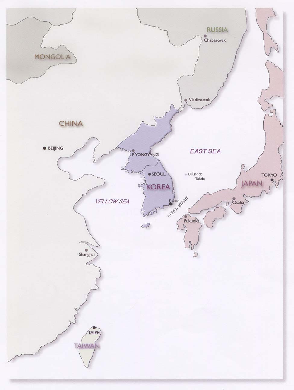
Korea
Korean Geography [Korea Society]
Vietnam
- Voyage to Vietnam [Children's Discovery Museum of San Jose]
What Can We Learn from Satellite Images?
Students will be intrigued by the many images of the Earth found at the USGS "Earth Shots" website. For example, here is China's "Three Gorges Dam".
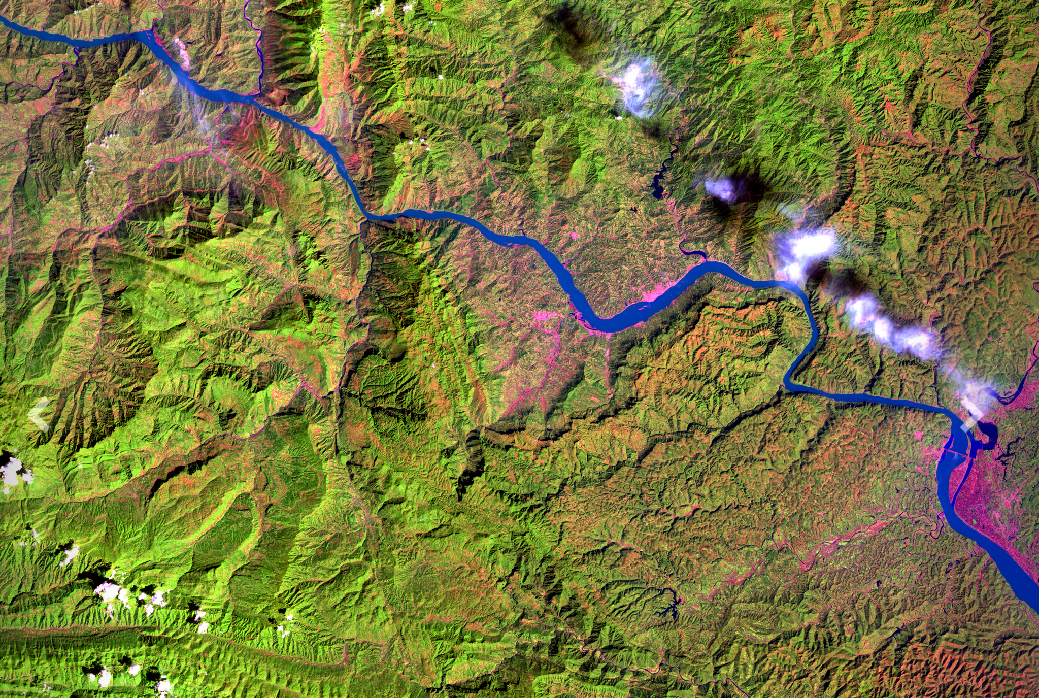
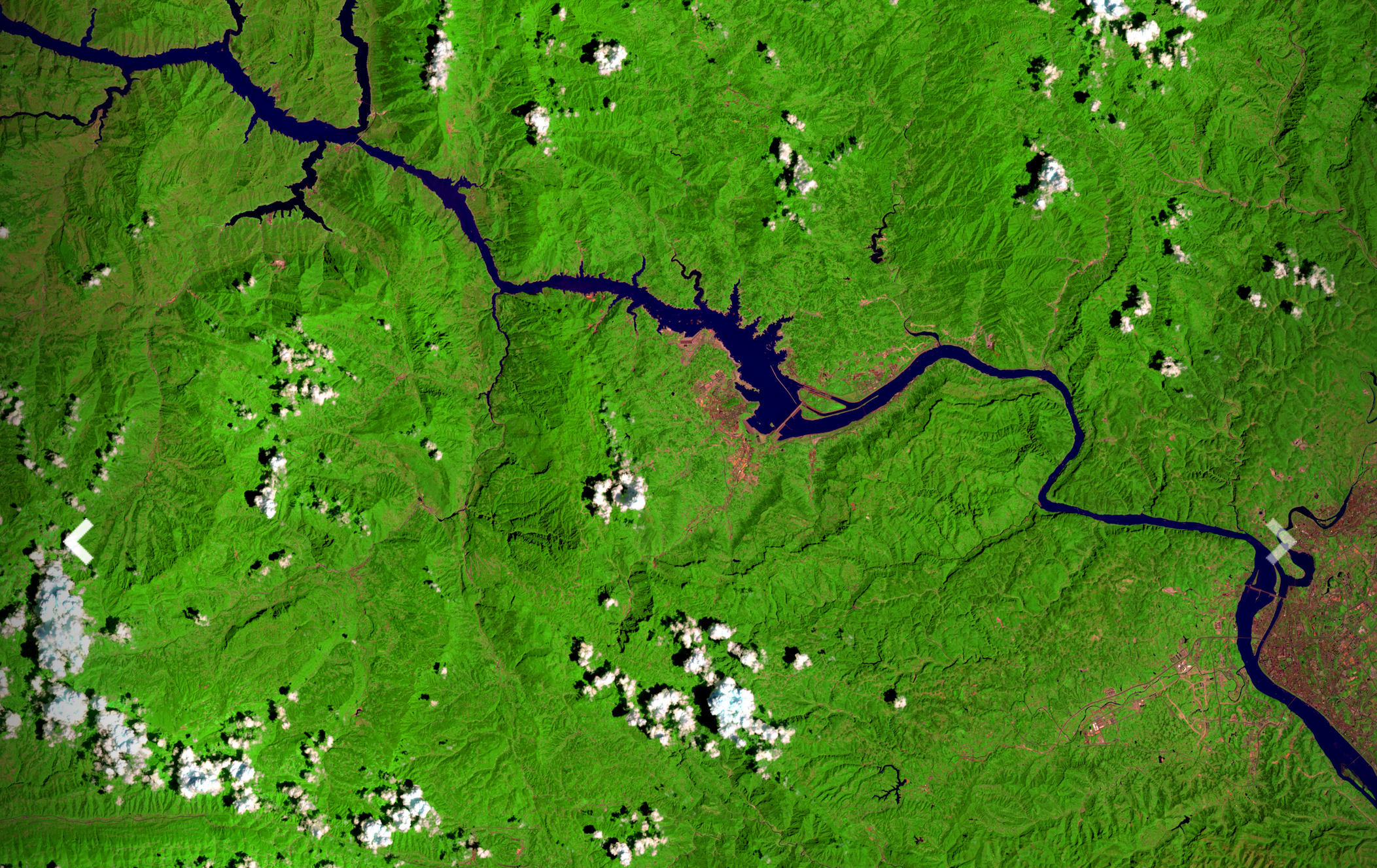 Satellite images of the Three Gorges Dam area in 1993 (top) and 2019 (bottom) from the USGS website, 'Earthshots: Satellite Images of Environmental Change'